Skip to content

Becoming a Fire Adapted Community

Rainbow Hill is committed to becoming a more fire-adapted and resilient community through preparation, education and shared responsibility. This page brings together trusted resources from Foothills Fire & Rescue and leading wildfire-preparedness organizations to help residents reduce wildfire risk, strengthen their homes and properties, create evacuation plans, prepare pets and livestock, and respond safely during an emergency. By taking practical steps before a wildfire occurs, we can better protect our families, neighbors and community.

Wildfire Risk Assessment

PDF
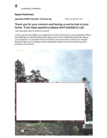
An example of the personalized wildfire risk assessment Foothills Fire & Rescue provides to homeowners at no cost. The report uses property photographs and location-specific recommendations to identify improvements in two areas: defensible space and home hardening. It examines wildfire hazards such as vegetation within five feet of the home, dead trees, ladder fuels, closely spaced tree crowns, stored firewood, combustible outdoor items, and accumulated leaves or pine needles on roofs, in gutters and around the property.

The assessment also reviews structural vulnerabilities involving vents, gutters, roofing, siding and other areas where embers, radiant heat or direct flames could ignite or enter the home. A property-owner checklist organizes the recommendations into an action plan and emphasizes high-priority improvements, including creating a noncombustible zone around the structure, limbing trees and installing ember-resistant vents. The sample report helps residents understand what to expect when requesting a free home wildfire assessment from Foothills Fire & Rescue.

Download "Home Assessment Report.pdf"

Wildfire Frequently Asked Questions

Small actions taken before a wildfire can significantly improve the safety of your household, property and community.

1. How do most homes ignite during a wildfire?

Up to 90% of homes destroyed during wildfires may first ignite from wind-blown embers rather than direct contact with the main fire. Embers can travel more than a mile ahead of a wildfire and collect in vulnerable areas around a home.

2. What is the most important area to protect?

The first five feet surrounding your home is the most critical area. Keep this zone free of combustible mulch, vegetation, firewood, patio furniture, leaves, pine needles and other materials that could ignite from embers. Rock, gravel, concrete and pavers are safer choices near the structure.

3. Why should roofs, decks and gutters be cleaned regularly?

Leaves, pine needles and other debris can trap embers and begin smoldering. A fire may not become visible until hours after the wildfire front has passed, so roofs, gutters, decks and areas beneath decks should be kept clear.

4. Can embers enter a closed home?

Yes. Embers can enter through unscreened vents, gaps beneath roofing, open eaves, garage doors and other small openings. Attic, roof, eave and foundation vents should be protected with corrosion-resistant metal mesh with openings no larger than one-eighth inch.

5. Where should firewood be stored?

Firewood should be stored at least 30 feet from the home, preferably uphill from or at the same elevation as the structure. It should not be stacked beneath a deck, on a deck or between trees. Vegetation should also be cleared around the woodpile.

6. Is defensible space a one-time project?

No. Defensible space requires ongoing maintenance because vegetation continues to grow and needles, leaves and branches continually accumulate. The home ignition zone generally extends from the structure to at least 100 feet away and should be evaluated every year.

7. Can one unprepared home affect the entire neighborhood?

Yes. Once a home ignites, it can produce intense heat, flames and additional embers that threaten nearby properties. Wildfire safety is most effective when residents work together and homes throughout the neighborhood are properly maintained.

8. When should residents evacuate?

An evacuation order means leave immediately. Do not delay to gather belongings, protect the home or wait to see whether conditions improve. Residents who need additional time because of children, disabilities, pets or livestock should consider leaving before an evacuation order is issued.

9. How will residents receive emergency alerts?

Jefferson County residents should register for LookoutAlert, the county's emergency notification system. Alerts may be delivered by phone call, text message and email. Residents should also monitor official local information during periods of high wildfire danger.

10. What should every household prepare before wildfire season?

Every household should prepare a go kit, identify multiple evacuation routes and decide where family members will meet. Plans should include medications, important documents, chargers, food, water, protective clothing and arrangements for pets or livestock. Vehicles should be ready to leave, and animal evacuation procedures should be practiced in advance.

Wildland-Urban Interface (WUI) Interplay of Ignition Mechanisms

Wildland-Urban Interface (WUI) fires—where human development meets undeveloped vegetation—are driven by a complex interplay of three primary ignition mechanisms: embers (firebrands), radiant heat transfer, and direct flame contact. Rather than a massive wall of fire directly consuming a home, most WUI structure losses result from embers starting spot fires in a property's immediate surroundings, which can then cascade into direct flame contact and intense structure-to-structure radiant heat.

Resources

Csfs oval 1955 green
The Colorado State Forest Service provides practical guidance, technical assistance and educational resources to help homeowners and communities improve forest health and prepare for wildfire. Its website includes information on defensible space, home and property protection, community mitigation planning, mountain pine beetles and other forest pests, post-fire recovery, grants and funding opportunities, and current wildfire conditions. Residents can also use the Colorado Forest Atlas to better understand local wildfire risk and connect with a local forester for property-specific assistance.
Evergreen wildfire ambassador program
Partnering directly with Evergreen Fire/Rescue (EFR), the Evergreen Wildfire Ambassador Program is a community-driven program designed to help residents and landowners prepare for wildfire.

The mission of the Evergreen Wildfire Ambassador Program is to help create community-wide wildfire preparedness by fostering neighborhoods that are self-sufficient, engaged, and sustainably adapted to living with wildfire.  This is done through Ambassadors and their teammates who serve as the core of the program.
Foothills Fire & Rescue
Foothills Fire & Rescue provides fire protection, emergency medical response support, wildland firefighting and community safety services throughout the Foothills Fire Protection District. Its website offers locally relevant information on wildfire mitigation, fire restrictions, emergency alerts, defensible-space planning, resident resources and the district’s Community Wildfire Protection Plan. Residents can also contact the department with safety questions, request assistance with property mitigation and learn how to support or volunteer with their local fire service.
Wildfire adapted partnership logo
Wildfire Adapted Partnership is a Colorado nonprofit that helps residents and communities reduce wildfire risk through education, planning and practical mitigation support. Its resources cover home wildfire-risk assessments, defensible space, slash removal, neighborhood ambassador programs, community assessments and Community Wildfire Protection Plans. Although many of its direct services are limited to southwest Colorado, its preparedness guides and planning materials provide useful, practical information for homeowners and communities throughout the state.

Fire Evacuation Checklist

PDF
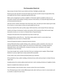
A practical, step-by-step checklist to help households prepare for and safely respond to a wildfire evacuation. It covers emergency go-bag essentials, protective clothing, food, water and pet supplies, medications, important documents, vehicle readiness and planning at least two evacuation routes. The guide also explains limited steps residents may take to secure their homes when time permits, while emphasizing that an evacuation order means leaving immediately without delaying to gather belongings.

Update: The document references the former CodeRED notification system.  Residents should instead register for LookoutAlert, which is the emergency notification system currently identified by Foothills Fire & Rescue.

Download "Fire Evacuation Checklist.pdf"

Wildfire Adapted Partnership Emergency Preparedness Tips

PDF
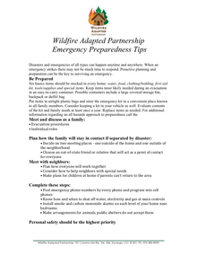
A comprehensive guide to preparing your household for wildfires and other emergencies. It explains how to create a family communication and evacuation plan, select meeting locations, identify an out-of-area contact, coordinate with neighbors and prepare for pets or household members who may need additional assistance. The guide also provides detailed checklists for home and vehicle emergency kits, including three days of food and water, medications, important documents, clothing, first-aid supplies, radios, flashlights and basic tools. It emphasizes following emergency officials immediately, knowing multiple routes out of the neighborhood and prioritizing personal safety over belongings.

Download "WAP Emergency Preparedness Tips.pdf"

Wildfire Adapted Partnership Evacuation Planning

PDF
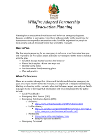
A practical guide for preparing and carrying out a wildfire evacuation before an emergency occurs. It explains how to identify primary and backup escape routes, select safety zones and a family meeting place, respond immediately to evacuation notices, prepare vehicles and essential belongings, and take limited steps to protect the home when time permits. The guide also addresses personal safety if escape routes become unsafe, planning for pets and livestock, and maintaining a portable 72-hour emergency kit tailored to the needs of everyone in the household.

Download "WAP Evacuation Planning.pdf"

Ready, Set, Go!

PDF
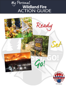
A step-by-step wildfire preparedness guide built around the Ready, Set, Go! approach. It explains how to reduce wildfire risk by creating defensible space, managing vegetation and strengthening vulnerable areas of the home against embers. The guide also includes household preparation, approaching-fire and evacuation checklists, with instructions for assembling a go kit, planning multiple evacuation routes, protecting pets, monitoring emergency alerts and leaving early when wildfire threatens. A fillable action plan helps households document emergency contacts, destinations, escape routes and the location of essential supplies.

Download "Ready Set Go Action Guide.pdf"

Red Flag Warning

PDF
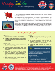
A practical guide explaining what a Red Flag Warning means and how residents should respond during periods of extreme wildfire danger. It outlines precautions to prevent sparks and accidental ignitions from equipment, outdoor fires, vehicles and dragging trailer chains. The document also emphasizes monitoring weather and local emergency alerts, maintaining defensible space, preparing evacuation routes and keeping a go kit ready so households can act quickly if a wildfire develops.

Download "Red Flag Warning Flyer.pdf"

Preparing a Community Wildfire Protection Plan

PDF
A step-by-step handbook for developing a Community Wildfire Protection Plan, or CWPP. It explains how local governments, fire departments, forestry agencies, federal land managers and community stakeholders can work together to map wildfire risks, evaluate vulnerable homes and infrastructure, identify priority areas for fuel reduction and recommend ways to make structures more resistant to ignition. The guide also covers creating an action plan, assigning responsibilities, identifying funding needs, establishing project timelines and reviewing the plan over time to ensure it remains effective.

Download "Handbook.Preparing CWPP.pdf"

Community Guide to Preparing and Implementing a Community Wildfire Protection Plan

PDF
A supplemental guide for communities developing, implementing and maintaining a Community Wildfire Protection Plan. It provides practical strategies and case studies for building effective partnerships, assessing wildfire risk, reducing structural vulnerability, prioritizing fuel-reduction and forest-restoration projects, and coordinating work across public and private lands. The guide also explains how communities can monitor progress, evaluate results and update their CWPP as risks, resources and priorities change.

Download "Community Guide.Preparing and Implementing CWPP.pdf"

Pet Evacuation Guide

PDF
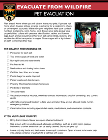
A practical evacuation guide for protecting pets and livestock during a wildfire. It explains how to arrange transportation and temporary shelter in advance, identify backup caregivers, prepare carriers or trailers, maintain identification and medical records, and assemble animal-specific emergency kits with food, water, medications and first-aid supplies. The guide also addresses defensible space around barns and pastures, backup watering plans, safe temporary areas for animals that cannot be transported and the importance of beginning large-animal evacuations well before conditions become dangerous.

Download "Pet and Livestock Evacuation.pdf"

Wildfire Preparedness for Horse Owners

PDF
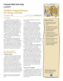
A detailed planning guide for protecting and evacuating horses during a wildfire. It explains how to assess local risk, identify and test multiple trailer-accessible evacuation routes, train horses to load quickly, coordinate transportation with neighbors and arrange temporary boarding in advance. The guide also covers horse identification, emergency records, medications, first-aid supplies, feed, water, halters and essential tack, while emphasizing that human safety comes first and evacuation should begin as soon as officials issue instructions.

Download "Wildfire Preparedness for Horse Owners.pdf"

Firewise Fact Sheet - Decks

PDF
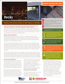
A burning deck can ignite siding or break the glass in doors or windows, allowing fire to gain entry into the house. Consequently, making decks less vulnerable to wildfire also
makes your house less vulnerable. Reducing the deck’s vulnerability requires an approach that focuses on the materials and design features used to build the deck, and creating a noncombustible zone around and under the deck.

Download "FirewiseFactSheetsDecks.pdf"

Firewise Fact Sheet - Coatings

PDF
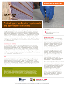
Buildings threatened by wildfire can be mitigated through the development of a strategy that addresses the built environment, vegetation, and other combustible materials on the property. Use of noncombustible materials and ember-resistant design features are examples of strategies that reduce the vulnerability of homes to wildfire. The use of coatings has been suggested as a strategy to provide enhanced protection against extended radiant heat and flame contact exposures for homes located in wildfire-prone areas, particularly when a combustible siding product is installed and other homes are nearby. In these cases, it can be argued that applying a coating is a less expensive option than replacing a combustible product with one that is noncombustible.

Download "FirewiseFactSheetsCoatings.pdf"

Firewise Fact Sheet - Roofing Materials

PDF
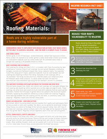
Homes ignite in one of three ways: embers/firebrands, radiant heat exposure or direct flame contact. An example of an ember ignition is when wind-blown embers accumulate on combustible materials such as a wood shake roof. An untreated wood shake or shingle roof covering is the greatest threat to a home.

Download "FirewiseFactSheetsRoofingMaterials.pdf"

Firewise Fact Sheet - Fencing

PDF
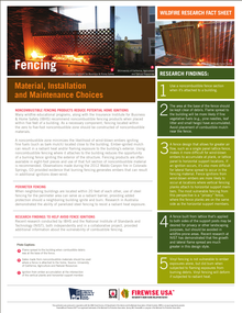
Many wildfire educational programs, along with the Insurance Institute for Business & Home Safety (IBHS) recommend noncombustible fencing products when placed within five feet of a building. As a necessary component, fencing located within
the zero to five-foot noncombustible zone should be constructed of  noncombustible materials.

A noncombustible zone minimizes the likelihood of wind-blown embers igniting fine fuels (such as bark mulch) located close to the building. Ember-ignited mulch can result in a radiant heat and/or flaming exposure to the building’s exterior.  Using noncombustible fencing where it attaches to the building reduces the opportunity of a burning fence igniting the exterior of the structure. Fencing products are often available in eight-foot pieces and use of that full section of noncombustible material is recommended. Observations made during the 2012 Waldo Canyon fire in Colorado Springs, CO provided evidence that burning fencing generates embers that can result in additional ignitions down-wind.

Download "FirewiseFactSheetsFencing.pdf"

Firewise Fact Sheet - Skylights

PDF
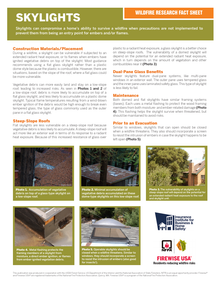
During a wildfire, a skylight can be vulnerable if subjected to an extended radiant heat exposure, or to flames when embers have ignited vegetative debris on top of the skylight. Most guidance recommends using a flat glass skylight rather than a plastic dome style because the plastic is combustible. However, there are situations, based on the slope of the roof, where a flat glass could be more vulnerable.

Download "FirewiseFactSheetsSkylights.pdf"

Firewise Fact Sheet: Under-Eave Construction

PDF
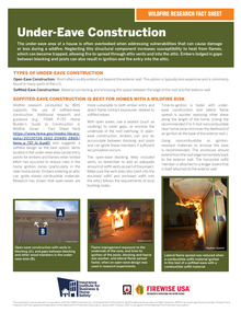
The under-eave area of a house is often overlooked when addressing vulnerabilities that can cause damage or loss during a wildfire. Neglecting this structural component increases susceptibility to heat from flames, which can become trapped, allowing fire to spread through attic vents and into the attic. Embers lodged in gaps between blocking and joists can also result in ignition and fire entry into the attic.

Download "FirewiseFactSheetsUnderEaves.pdf"